Tag: hiking index
-
Katmai
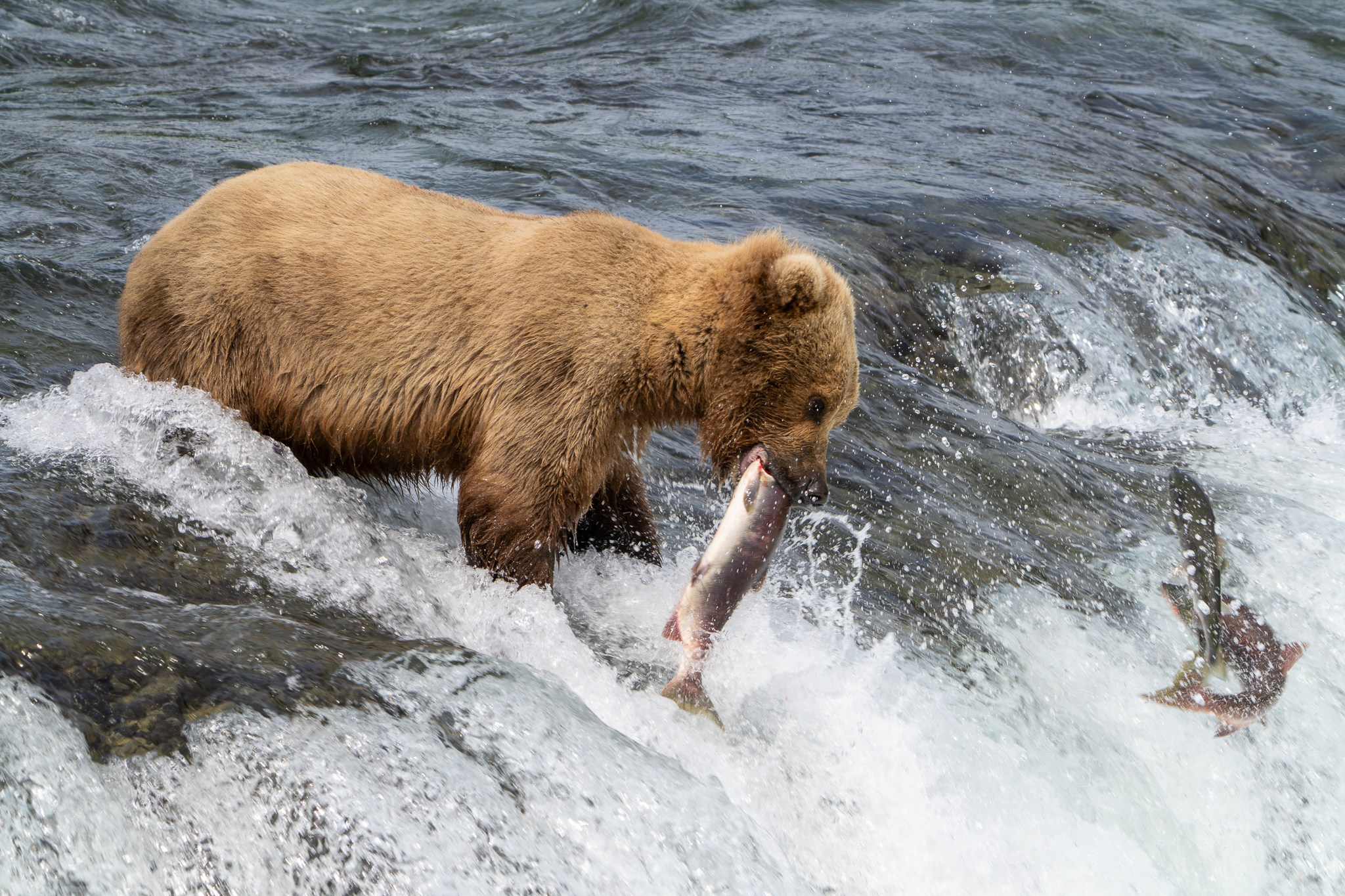
We disembark onto a private bus. There are a few others with us. Making our way through the Anton Anderson Memorial Tunnel, we soon arrive at the Anchorage airport. I check the car seats and bags for city travel at the storage facility, then board our flight to King Salmon. There is no reception in…
-
Twenty Lakes Basin
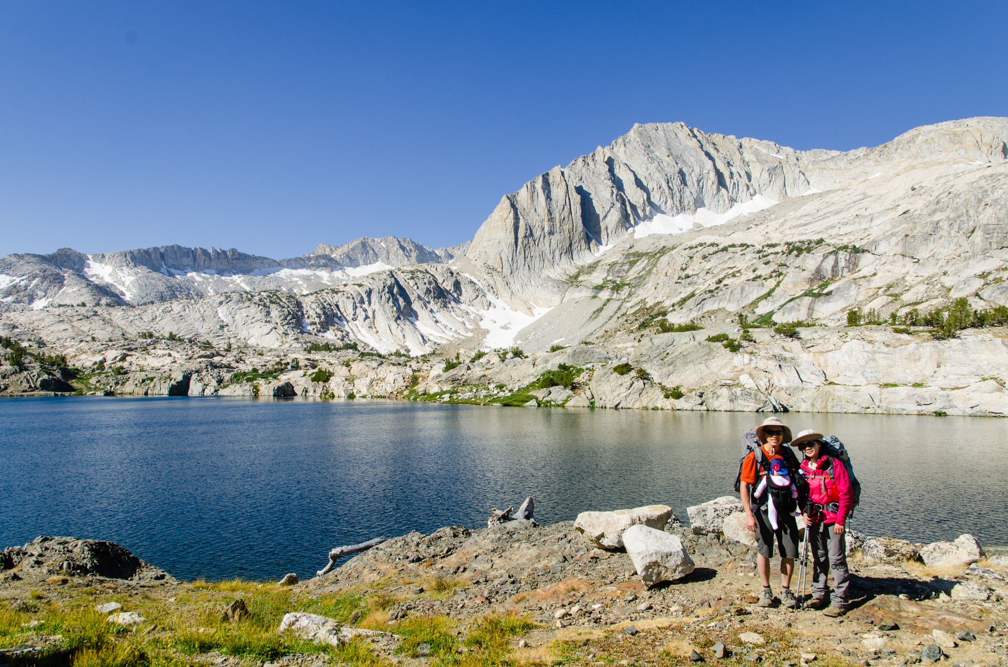
Having successfully camped for two nights and hiked at high altitude, we figured it was safe to go backpacking. This will be Daphney’s first trip into the backcountry wilderness.
-
Big Pine Creek, Rock Creek, Heart Lake
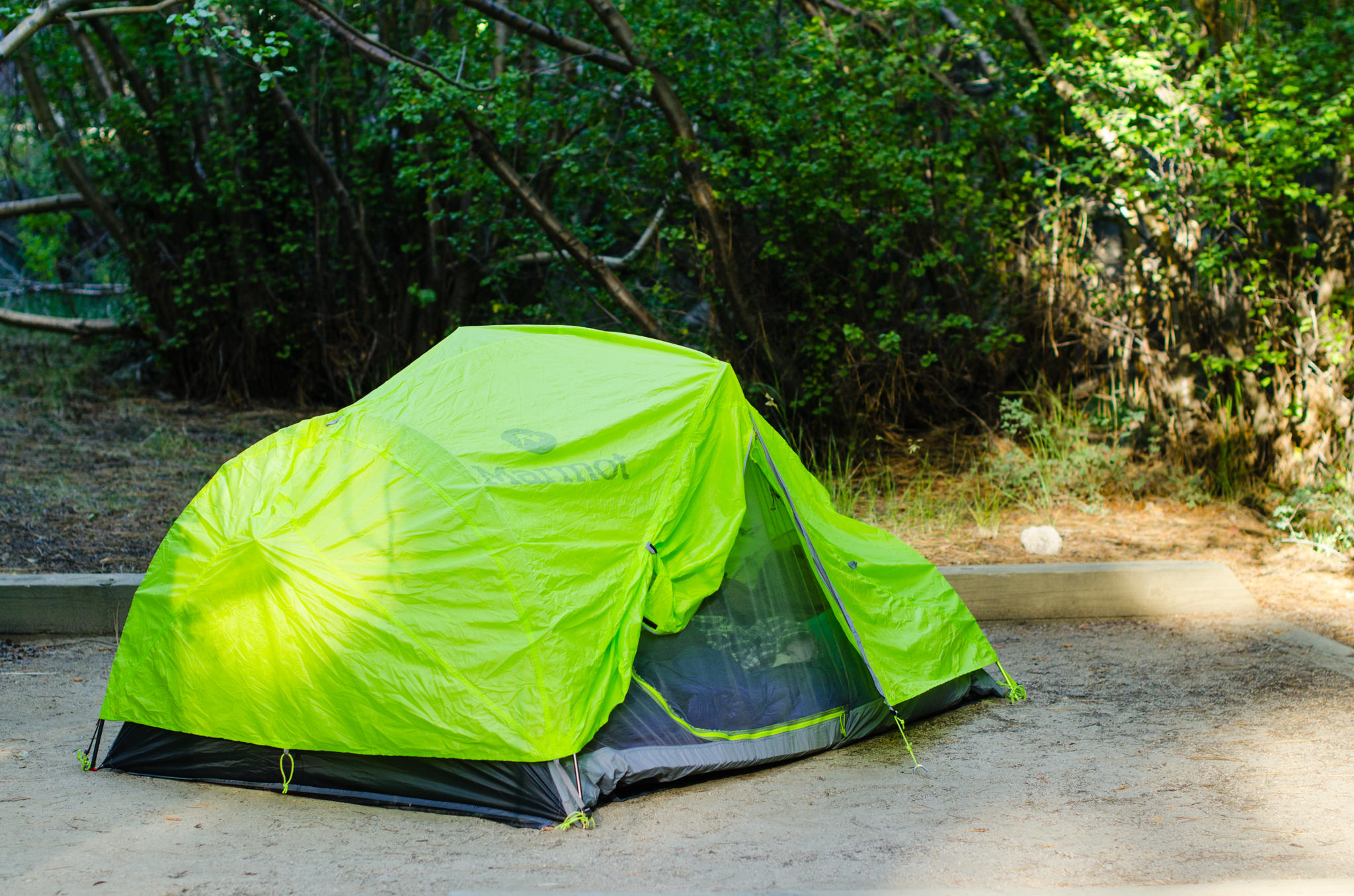
It’s going to be Daphney’s first camping trip. I’m a little nervous about the altitude. Days before, I had been researching high altitude problems in babies. I had read that staying below 2500 m (8200 ft) is safe, but approach 3000 m (9840 ft) carefully. Since we’re staying at Big Pine Creek (7600 ft) the…
-
Seattle, Mt. Rainier, and the Olympic Mountains
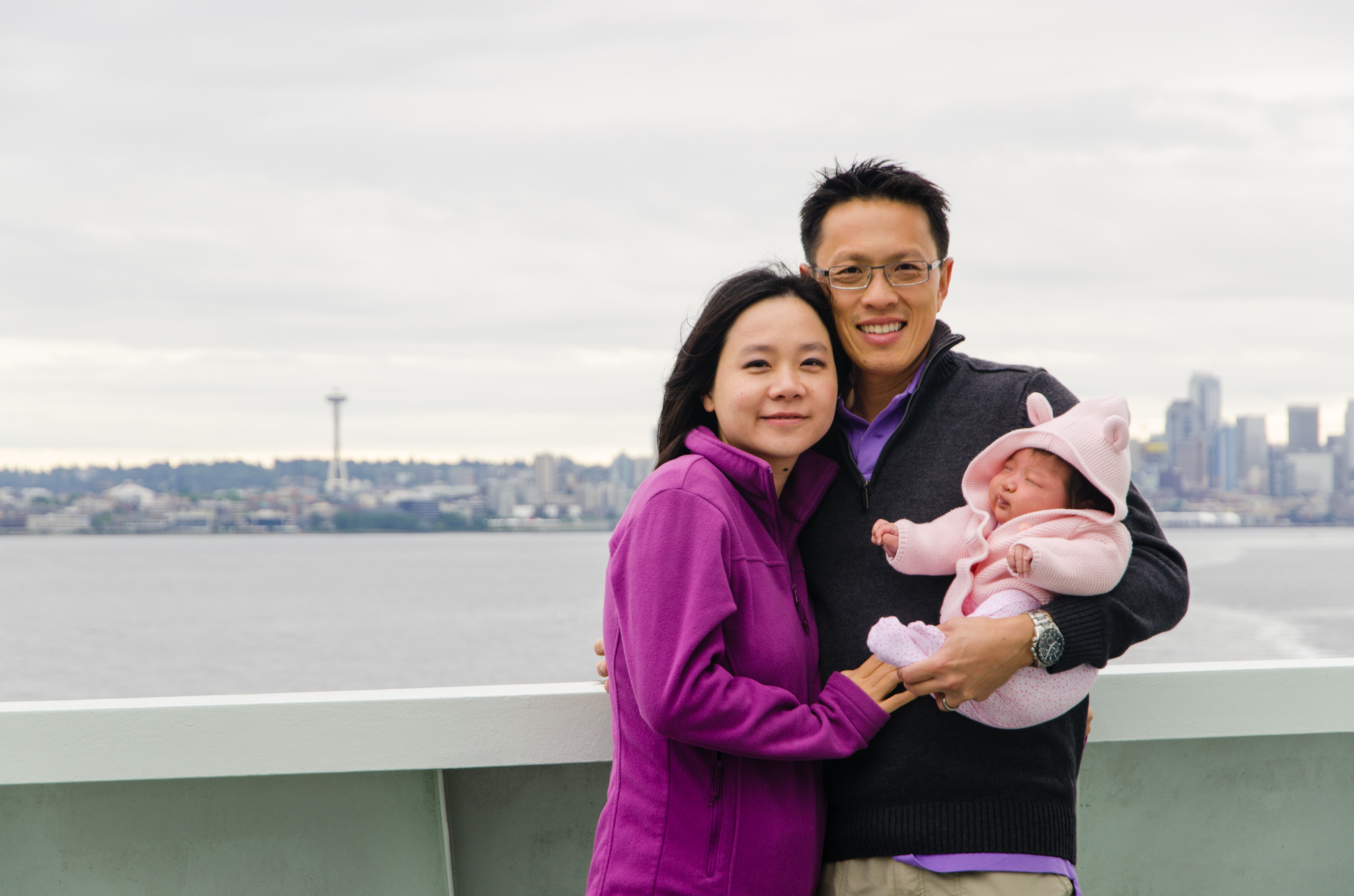
We’re heading to Seattle for me meeting at the American Orthopaedic Association. This first flight for Daphney goes well, and she isn’t the least bit bothered by the cabin pressure changes. Aside from the meetings, Seattle brings us great opportunities for sightseeing. Daphney gets her first rental car ride. She visits the original Starbucks. We…
-
San Jacinto Desert View Trail
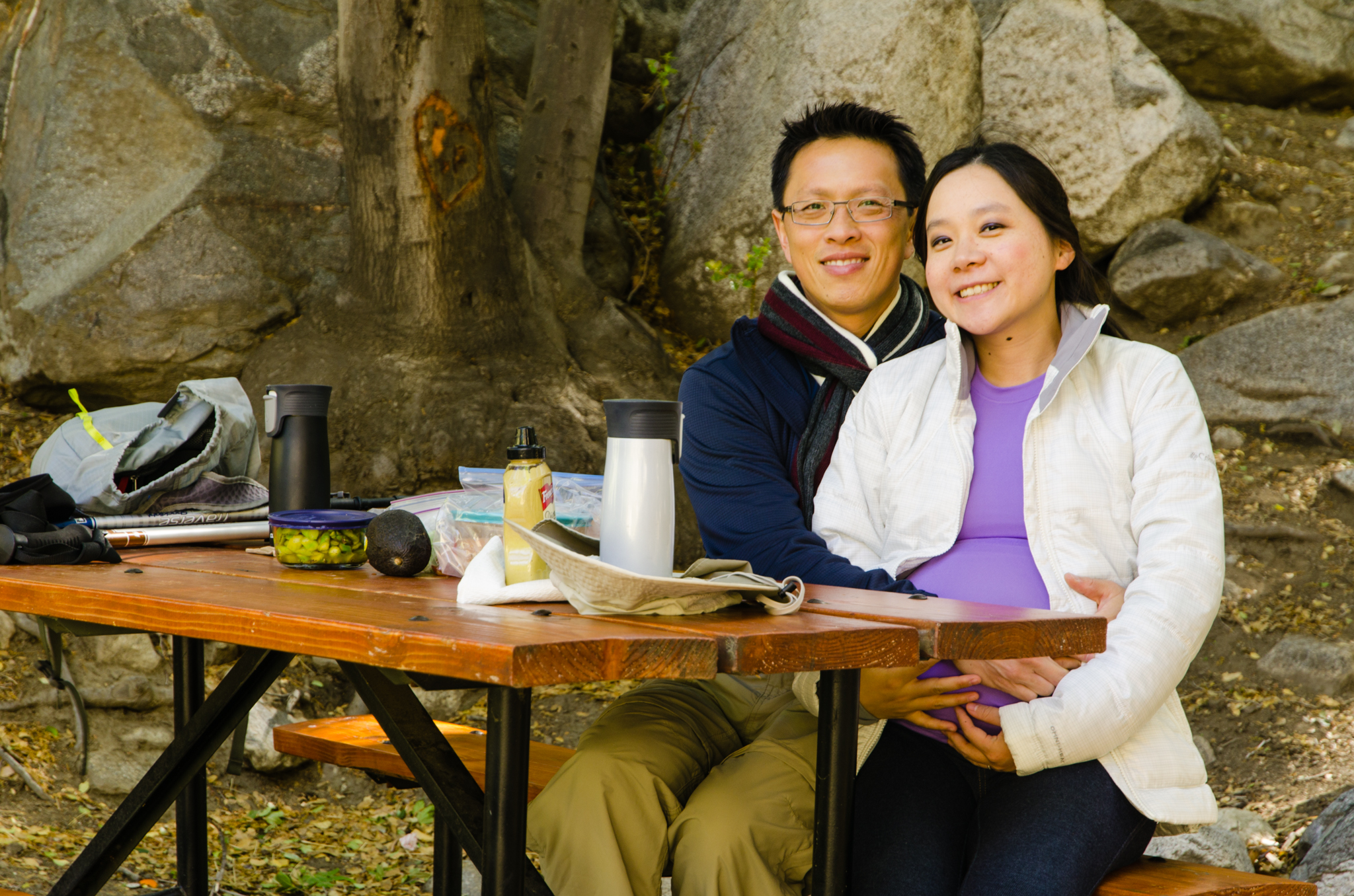
Yan and I have been enjoying taking pregnancy pictures, and with our love for the outdoors, San Jacinto seemed fitting. We drive out to Palm Springs, get tramway tickets, and have lunch there while waiting for our turn. This time, it’s homemade flatbread with vegetables. Once at the top, we have little time to do…
-
Etiwanda Falls
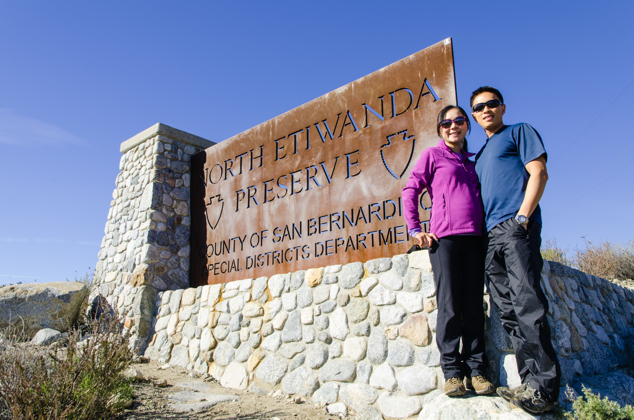
It’s New Year’s Day, and we want to start off the year by being active. We decide to do this popular hike to Etiwanda Falls. From the reviews, this trail has great ratings. We arrive at the trailhead parking early, and parking lot nearly full. We park, pack up, and start the hike. This trail…
-
North Cascades
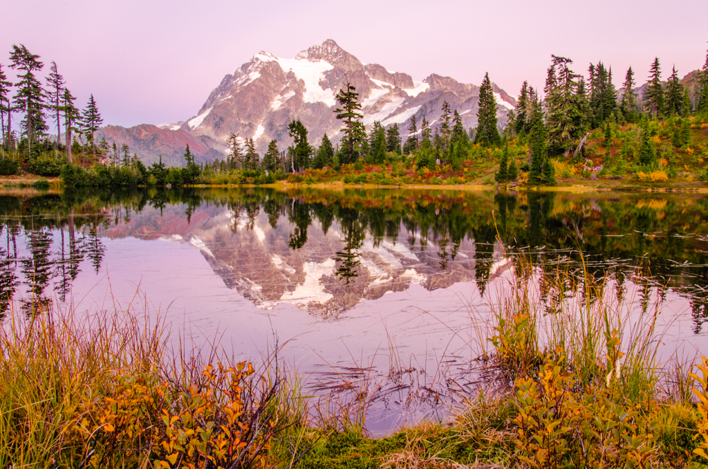
It’s early Sabbath morning, and I take off early for the mountains. The destination will be the North Cascades. The day before, I had researched the area, and it looks like one of the most accessible trails with the best views is the Hannegan Pass trail. So, this is the one I chose. Driving up…
-
Yosemite and LA
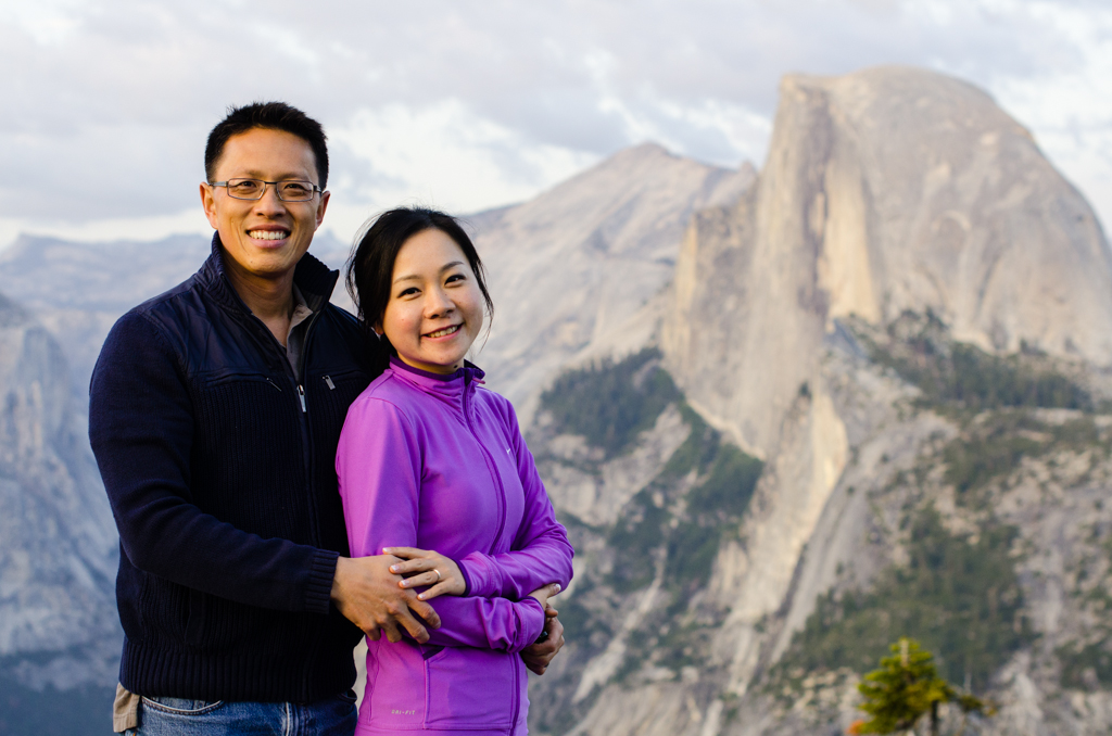
This first day of being married begins after catching up on much-needed rest. The wedding ceremony yesterday and the reception last night went exceptionally well, and just about everything went as planned. This morning is beautiful. We stand on the balcony to take in the crisp morning air. After a lazy breakfast buffet and getting…
-
Mount Washington
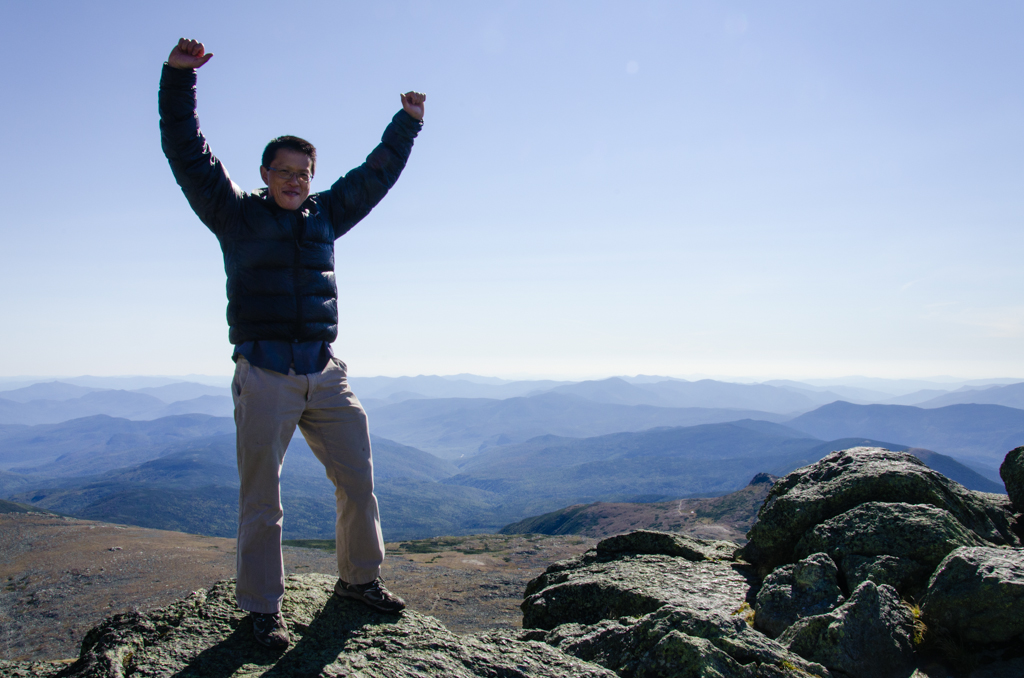
This has been a phenomenal hiking season. Starting with summiting one of the most prominent mountains of Southern California—Mt. San Jacinto, the peakbagging list includes Mauna Kea, Mount Whitney, and now Mount Washington. I’ve read about Washington many times. Visiting Boston for the American Society for Surgery of the Hand meeting, I knew I had…
-
Mauna Kea
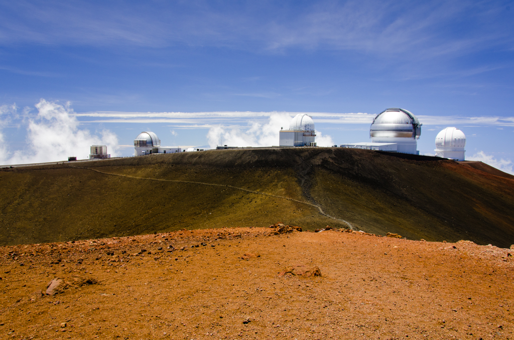
We could have just driven up there, against the car rental policy. I didn’t actually read the verbiage, but according to a lot of websites, most rental car companies prohibit driving up the road from the Mauna Kea Visitor Information Station to the top. So, we decided to hike it. Joining me are my senior…
-
Mt. San Jacinto Peak

This trip was to realize what was left unaccomplished last time with the Orthopaedic Surgery Interest Group (OSIG). The goal, for those of us who are struck with summit fever at times, was to stand on Mt. San Jacinto’s peak. Andrew, Co-President of OSIG, had sent out the notices weeks before, and the original student…
-
Marion Mountain Trailhead to Little Round Valley
We had hopes of making it to the summit. Jackson and Corey had planned this trip for the Orthopaedic Surgery Interest Group weeks ago, but today, thunderstorms and lightning threatened the exposed peak. We turned around at Little Round Valley, which was just a little more than a mile from the top. A small group…
-
Mount Baldy Peak
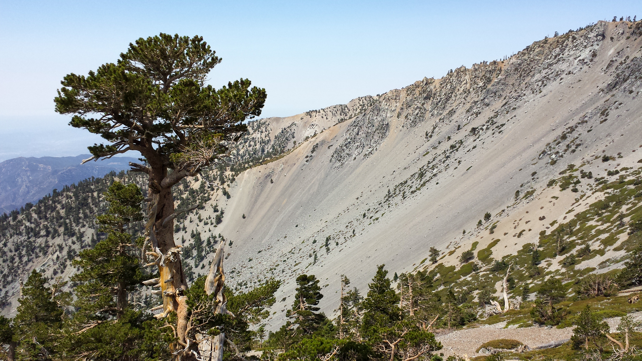
We left Loma Linda a little after 5:00 am. By 6:20, we were on the trail, ascending up the Baldy Bowl Trail, otherwise known as the Ski Hut Trail. At the Hut, we have breakfast over scenic views. The mileage varies, but on one report, it is 4.2 miles from the Manker Flat parking lot…
-
Hollywood Sign
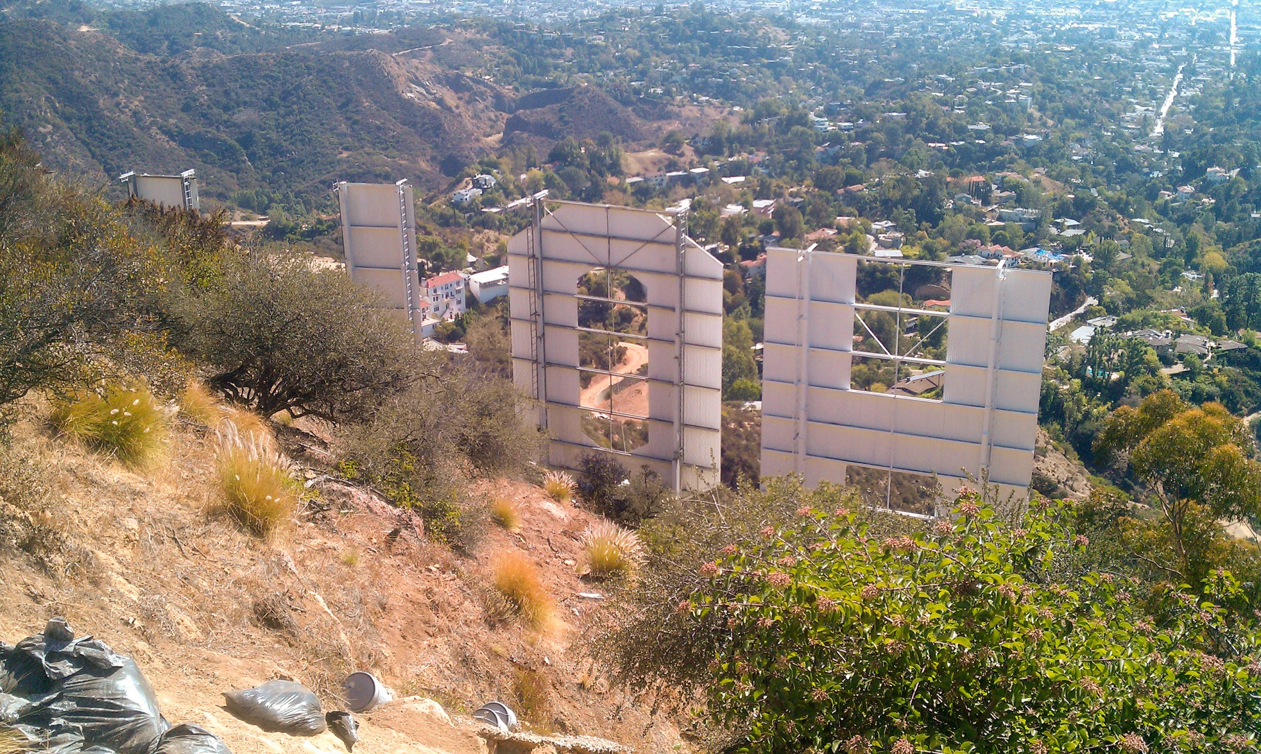
The hike to the Hollywood Sign started at the end of Beachwood Drive, just by Sunset Ranch. The horses from the ranch dusted up the first part of the trail—not just from hoofs and horseshoes. After the fork to the left, it got much better. The midday sun was beating down pretty hard. Just before…
-
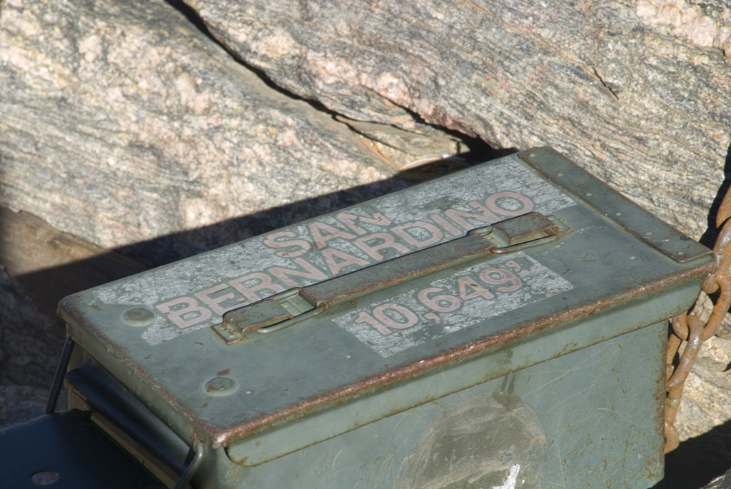
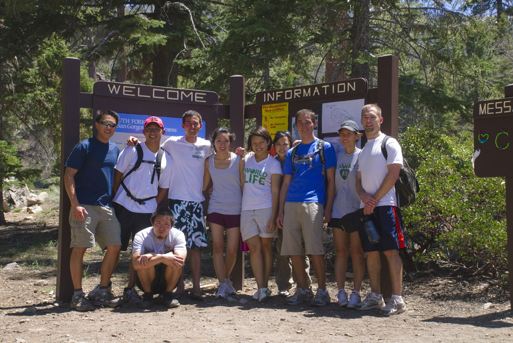
San Bernardino Peak
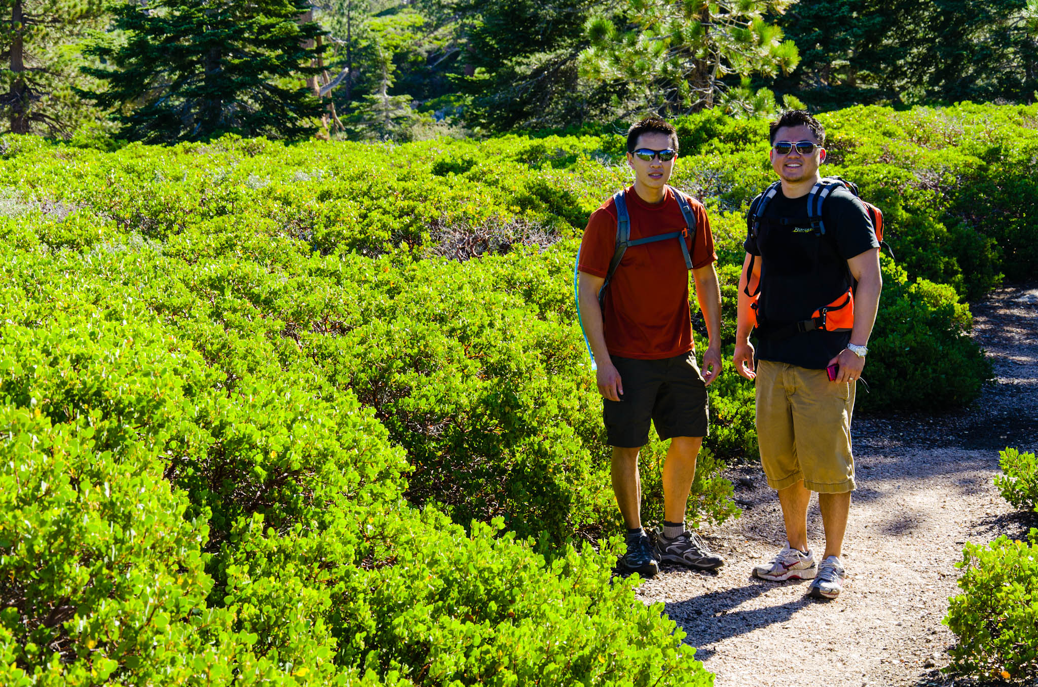
It started from a Facebook invitation, where I basically invited everyone who I thought would be interested in going. We all met in the Allen Way cul-de-sac just before 6:00 this morning and drove to the parking lot. There were orthopaedic residents, Ben, Mark with Sarah, and Lucas; medical students, Chris, Andrew, Charlie, Bjorn, and…
-
Portland, Columbia River, and Silver Falls
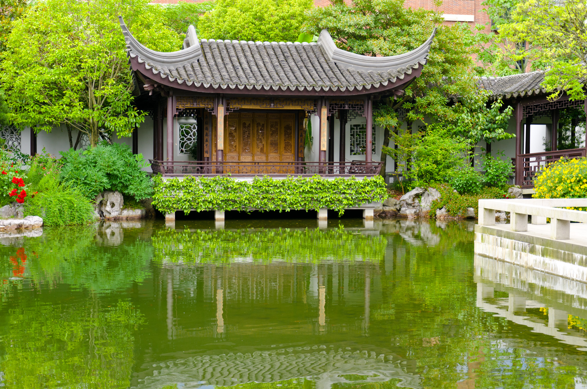
Arriving in Portland on Tuesday gives a slow transition to the next part of this extended time away. Activities for the Western Orthopaedic Association starts on Wednesday. I spend most of Wednesday morning touring the Portland Chinese Garden 蘭蘇園, taking time to follow the self-guided tour explained in the brochure. For the last stop, I…
-
Lake Louise and Surroundings
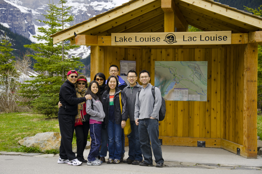
I’m the first to get up. Daylight hours are long here, and although a cloud layer covers the dawn sky, it’s already bright outside. I make coffee and take in some early morning fresh air from our balcony. Everyone sleeps in. For breakfast this morning, we have omelettes stuffed with onions, diced tomatoes, sliced black…
-
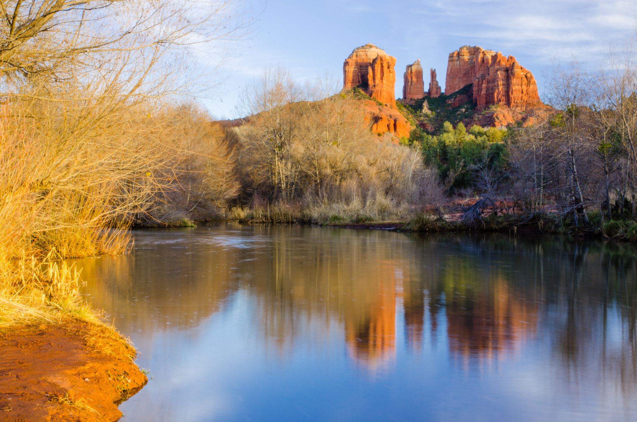
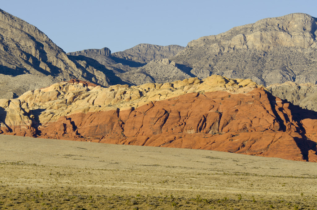
Red Rock Canyon
This past week, I was at Red Rock Canyon. The main reason for visiting was to attend the American Association for Hand Surgery, which was held at the Red Rock Casino Resort & Spa. The meeting started on Wednesday, and I went as an invited faculty member. Thursday afternoon was free, and I had a…
-
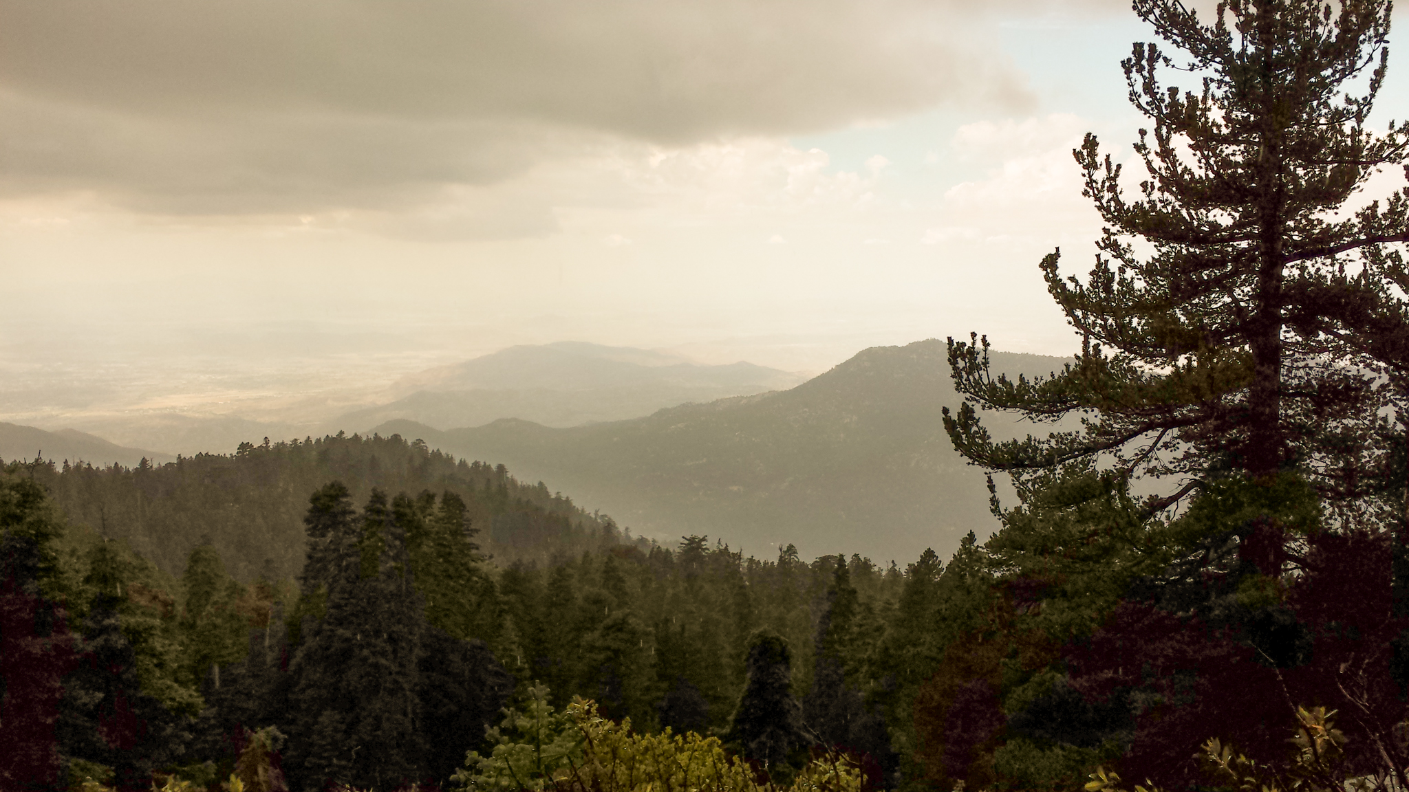
San Gorgonio Peak
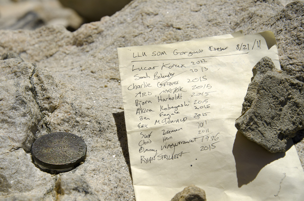
This trip took me and our group of residents and medical students from the Vivian Creek trailhead to San Gorgonio Peak. […]
-
Mount Rubidoux
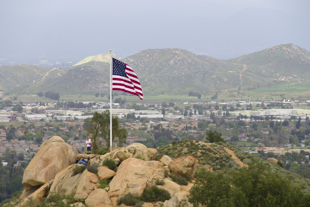
We had a great time hiking up Mount Rubidoux. I got to bring our new puppy Durian out for an excursion.
-
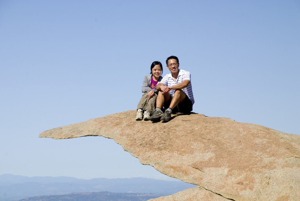
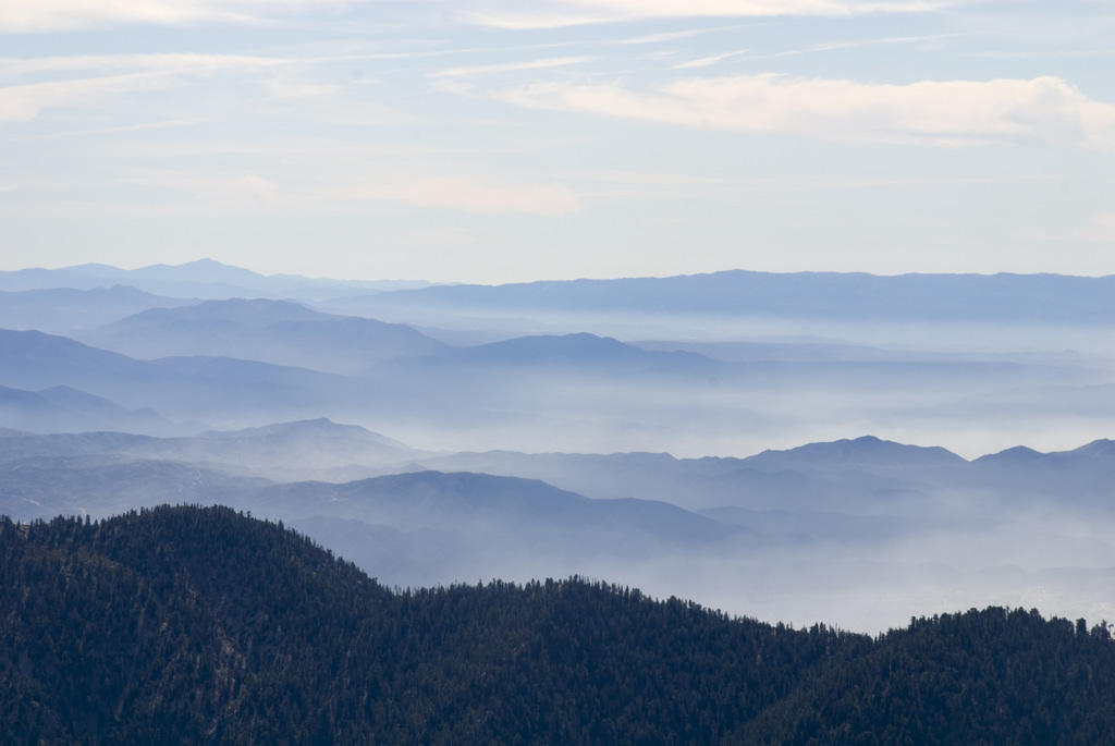
San Bernardino Peak
A group of us climbed San Bernardino Peak from the trailhead near Angelus Oaks. The weather, of course, was beautiful. Views from the top were breathtaking, especially at the turn just below the survey monument. These pictures are courtesy of Rob Quigley and Adam Lorenzetti.
-
South Fork Trail
Starting from the South Fork trailhead in the San Bernardino National Forest, a group of us hiked up passed the meadow and up to the avalanche area. After that, we turned around and headed back down the mountain.
-
Mount Woodson
A group of us drove down to Poway and hiked up to Mount Woodson. Near the summit, there’s an outcropping called Potato Chip Rock, which is completely fitting for its name. We had a nice picnic lunch at the top. Then, we hiked back down, and a few of us decided to ignore the signs…
-
Angelus Oaks to San Bernardino Peak
We climbed San Bernardino Peak today. The hike started from Angelus Oaks. We left Loma Linda around 6:00 am, arriving at the 1W07 trailhead forty minutes later. It was cold, but I started out in shorts, a quick-dry t-shirt, and a beanie to prevent heat loss through the head. It turned out to be fine,…
-
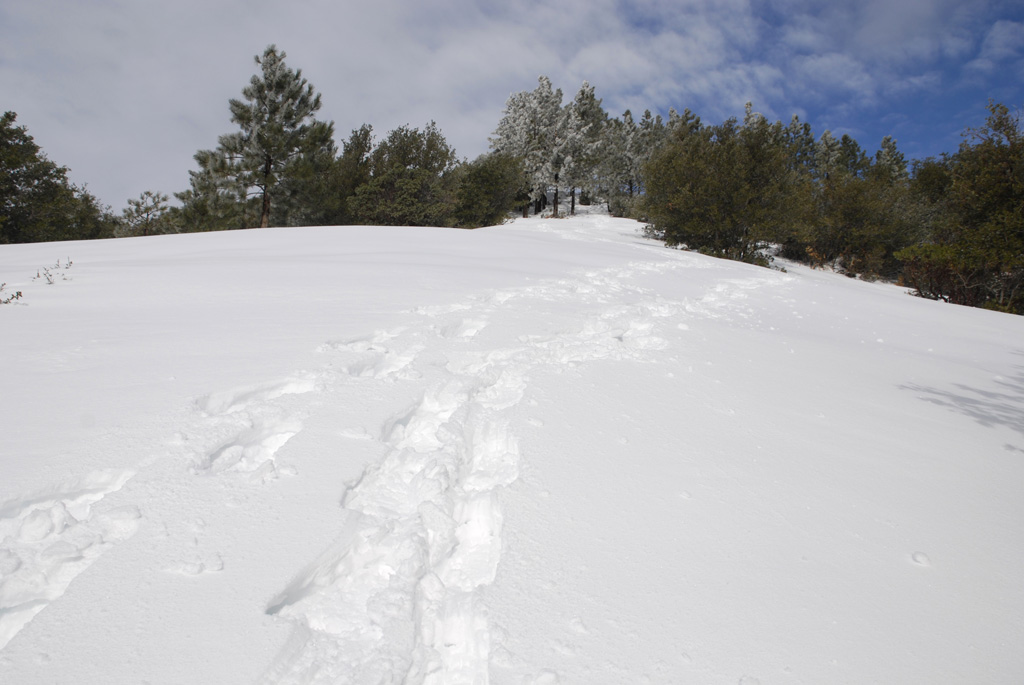
Angelus Oaks Snowshoe
This snowshoe trip was more strenuous than I had expected. Uncle Ben Vassantachart and I went up to Angelus Oaks and parked by the restaurant. We followed the trail up to the helipad and spent some time exploring. After getting to that plateau, we decided to come straight down the mountain, cross country style. Some…